Cherkasy region map guide
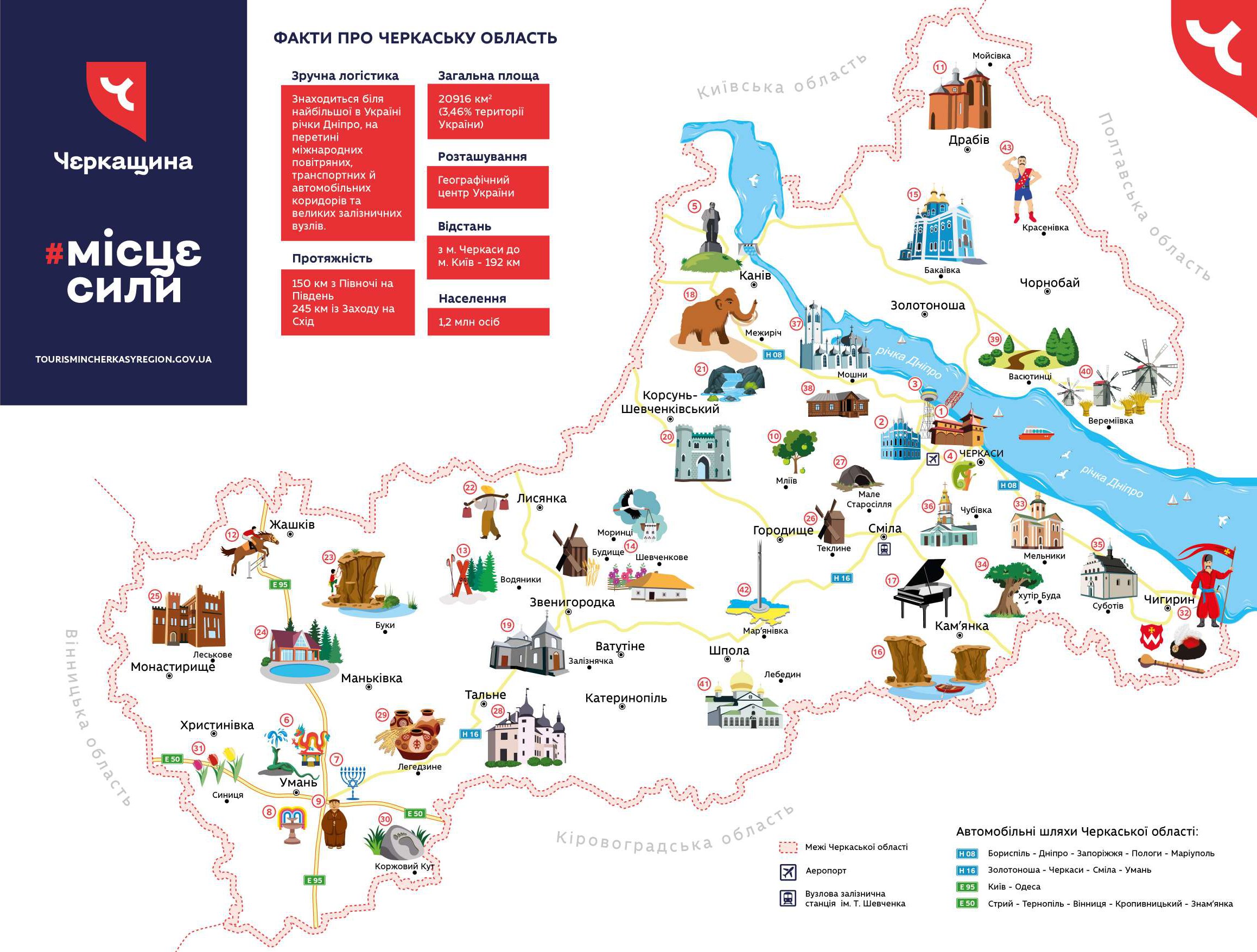
Tourist map of Cherkasy region with 43 places worth visiting, by the Department of Regional Development of Cherkasy Regional State Administration (brand “Cherkasy region — a place of power”).
Download the map (PDF, 0.8 MB)
Facts about Cherkasy region
- Convenient logistics: Located on the Dnipro, the largest river in Ukraine, at the crossroads of international air, transport and road corridors and major railway junctions.
- Length: 150 km from north to south; 245 km from west to east
- Total area: 20,916 km² (3.46% of the territory of Ukraine)
- Location: The geographical centre of Ukraine
- Distance: Cherkasy — Kyiv: 192 km
- Population: 1.2 million people
The descriptions of the 43 places on the map are available in Ukrainian.